Tuesday, December 31, 2013

2013 In Review: GSA in Denver

Okay, last up for the year in review (I'm not going through spring/summer things, because vacation).

In late October I journeyed out to Denver for the annual Geological Society of America meeting. This year I had some special projects planned. First, I brought along my Kinect scanner - and Steve Gough of Little River Research and Design was kind enough to let me set it up on one of their stream tables on display. Second, I brought our high speed camera to catch the Emflume in operation.

There was a Mythbusters exhibit at the DMNH while I was there (some might call this a running gag for the year)

A very Daffy-Duck looking hadrosaur.

Went on a photography field trip, got to give my tilt-shift lens a workout.

The camera and lighting of the flume.

Just like any good party, every flat surface is covered in empties and wounded soldiers.


The Kinect scanner - mounted on a lighting stand and placed over the table. The computer is hooked up to the large monitor in the background so people could see the live 3D image.

This is what the stream table looked like after a day of visitors.

Steve hoping the day would go well. Or appealing to the powers of Arduino to get his time-lapse slider to work properly.

Ron Schott (fellow UW-Madison alum and one of the few students who were there longer than I was) was trying out his Google Glasses.


Which I got to try out. A little awkward when worn over regular spectacles, but I can see some potential uses for the technology for science outreach.


gx8 1917-Emflume9-sed-trans from Matt Kuchta on Vimeo.


gx8 1917-Emflume7-paddle from Matt Kuchta on Vimeo.


gx8 1917-Emflume10-paddle from Matt Kuchta on Vimeo.


Monday, December 30, 2013

2013 In Review: TED Ed

Another great thing this year was getting to go to New Orleans and talk to a bunch of Middle and High School students about science. I gave a 6 minute talk about "sand" and got to talk with a bunch of motivated students.

There's something special about those three red letters and the little orange mic that makes a person feel like they're giving a "real" talk.
Obligatory selfie during rehearsals.


I'm glad my shoes matched my shirt - otherwise it would have looked like I was just this hawaiian-shirt clad torso.

Photo by Ryan Lash


Photo by Ryan Lash

I also gave students instructions on proper hand-lens technique. Remember folks, hold the lens to your eye and bring the object into focus.

Photo by Mike Femia

My trip was made more interesting by the fact that I had one of the worst head colds in my life right before I left. I could barely talk and my head was so stuffy it sounded like I was talking to people inside a diving helmet that had been filled with jell-o. But I managed to get enough rest and got through my talk and survived the first intermission talking to students - my voice totally gave out during the second intermission - which was too bad. I wish I could have talked to more kids about geology. But the table next to me had enough cool whale parts to keep kids entertained far better than I could with a few rocks and bags of sand.
Anatomist Joy Reidenberg with her table of whale parts. Those are 8' long sheets of baleen (blue whale I think)

Homologous structures FTW!

Big crowd at the Civi Theater. Those screens on the balcony ledge were there so we could see our slides without turning our backs to the audience. The red light between them showed how much time was left.

Did I mention that Ashton Kutcher was the secret guest speaker?

That's some Bass! from Matt Kuchta on Vimeo.

16-year-old DJ Cole Plante's presentation came with plenty of low frequency rhythm. Here's a water bottle sitting next to one of the balcony lights. The waves were generated by the bass line of Cole's music mix.

I had a blast - thanks to the TED team for making it fun for those presenting. I got to meet physics blogger Rhett Allain, share a cab ride from the airport with robot scientist James McLurkin, talk photography with Jonathan Mannion, and share a cab ride back to the airport with the head of Pixar's Research Group. There were several "kids" that gave talks, too - although "young adult" really is appropriate here. I can't imagine what it's like to be 14 years old and get national recognition for the transformative/innovative things they've already done (in some cases since they were eight).

Sunday, December 22, 2013

2013 In Review: Mythbusting

As the calendric transition into 2014 draws nigh, many of us go through some of the highlights (or lowlights) from the past year. This year brought with it some absolutely wonderful things.

First on my list is the "Behind the Myths" stage show that my wife and I went to a few weeks ago. This was the second tour they did for this show and it finally rolled into a theater near me. In this case the State Theater in downtown Minneapolis.

The Marquee.


Before the show - they had some promo vids for the upcoming season of Mythbusters as well as some info about the Tested.com website.


I got the chance to go up on stage - they wanted an "athletic" type to participate in one of their demos. I  wish I had brought something for Adam to sign while I was up there. Oh well...


I'm not going to spoil the actual demo, but you can get an idea of what it was based on these photos.


I have no idea what Adam and Jamie were telling the audience at this point - I was trying to pedal and the poncho was blocking my hearing.


I ended up "losing" the contest. But getting drenched with a water balloon onstage with Adam and Jamie was appropriate on many levels.


Demonstrating phonebook friction. I have been meaning to blog/demo this idea for a while now.


Some of the slow-motion demos they were doing. They were using a camera manufactured by the same company (NAC) as the one we have here in our department.


The show finale included a lot of paintballs. And a volunteer/target suited up in plate armor. Notice the person-sized gap in paintball spatter on the lexan shield.


All in all it was a great show. As a science educator/communicator, there were things I thought they could have done differently/better, but that didn't detract from the overall quality of the show. It was, after all, first and foremost entertainment. It also is a promotional venue for Mythbusters and Tested.com - so there are the obligatory commercial aspects that accompanied the show itself - both in terms of show clips and merchandise.

The central theme of the show was a fascination with the nature of science. Experimentation, data collection, testing ideas, and verification. But also a love of the process and of the physical world around us. They also emphasized how their show had a positive impact on people who had traits on the Asperger's Spectrum - something that I've heard them mention before. It reminded me that these kinds of shows can serve as the gateway to learning.

They don't have the depth and breadth that are really necessary for a full education, but they get people excited about the concepts. This excitement develops the internal motivation for further learning. And given the emphasis on external motivation in our educational system (like federally mandated testing), programs that encourage students to learn for themselves are important.

Friday, December 20, 2013

Happy Holidays!

For the last couple years, I've taken time during finals week (once the exams were graded) to shoot some holiday-themed slow motion video. I had found some clear glass christmas tree ornaments that seemed perfect for smashing. I rigged up a simple "Newtons Cradle" and experimented with just getting them to swing back and forth. The conservation of momentum in these collisions is pretty complex, but fascinating to watch.


I recommend watching this full screen:
 Newton's Cradle from Matt Kuchta on Vimeo.
Mostly filmed at 1,000 fps with memrecam gx-8.

Music by "Live Action Fez" http://freemusicarchive.org/music/Live_Action_Fezz/A_Very_Badgerland_Christmas_2011/Live_Action_Fezz_-_A_Very_Badgerland_Christmas_2011_-_15_Carol_of_the_Bells

The stage was backlit using a sheet of white acrylic and a 500W tungsten lamp.


Satisfying glass ornament carnage.


To get the balls to break predictably, I took a bit of corundum and scratched a little "X" at the impact point.


Monday, December 16, 2013

Unnatural Histories: The Lonely Mountain - Part 6

If you've missed the other bits, be sure to check the rest of the series:
Part 1: http://pascals-puppy.blogspot.com/2013/12/unnatural-histories-lonely-mountain.html
Part 2: http://pascals-puppy.blogspot.com/2013/12/unnatural-histories-lonely-mountain_16.html
Part 3: http://pascals-puppy.blogspot.com/2013/12/unnatural-histories-lonely-mountain_9632.html
Part 4: http://pascals-puppy.blogspot.com/2013/12/unnatural-histories-lonely-mountain_1042.html
Part 5: http://pascals-puppy.blogspot.com/2013/12/unnatural-histories-lonely-mountain_5911.html

Okay, so far I've proposed that the Lonely Mountain is the eroded remnant of the intrusive igneous and hydrothermal component of an ancient arc-volcanic system. Going back to the earlier part about the Misty Mountains, we can now look at this mountain system with a slightly different view. The Misty Mountains is our currently active collisional tectonic feature. The Ered Mithrin could be made of reactivated sutures (from various accreted terranes as Forodwaith and Rhovanion converged on each other) plus erosional highs of more resistant rocks formed through earlier tectonic activities.


What I like about this model is that it doesn't require plate tectonics to be "active" everywhere all at once. Not every feature we see on earth is a result of currently active tectonic processes. Many features are the remnants of past activity. Think of them as a kind of of tectonic "fossil" that has survived simply by not being completely eroded away.

So that has me wondering: do Dwarves or Dragons use a tectonic model of economic geology to decide where they want to live?


Unnatural Histories: The Lonely Mountain, Part 5 - Iron and Tectonics

Okay, the story so far: we've got this "paleo-continent" of Rhovanion with features like the Lonely Mountain and the Iron Hills. Looking at the formation of gold deposits, the most common places on earth include late-stage igneous melts and hydrothermal systems. Something more easily found deep in the bowels of a volcanic system rather than at the surface. Let's take a few moments to look at the Iron Hills - a few leagues to the East. If our volcanic system was once an island arc, could we get iron somewhere from this system too?

Iron ore minerals. Left to right: Taconite pellets, massive hematite, banded iron formation (BIF). Taconite pellets are processed silica-rich iron ore that has been pelletized for easier transport by rail and boat.

Again, let us look to some real-world examples. Most of the iron mined in the world today comes out of "banded iron formations" found in places like Northern Minnesota, Wisconsin, and the Upper Peninsula of Michigan. Other places around the world include the Pilbara region of Western Australia. Many of these deposits are old - like 1-3 billion years old - old. Most of these deposits are associated with deeper marine waters, such as continental shelves or abyssal plains in the open ocean. Conveniently, this deep-water setting is something that could also form in proximity to an island arc. And just for the sake of completeness, an island arc can also be home to carbonate reefs. And carbonate rocks at the surface can yield karst (caves & sinkholes) topography - including caves vast enough to house the elven Woodland Realm palace of King Thranduil. Fun times!

An unexpected tectonic journey: a subducting island arc and associated back-arc basin. The raw materials for our Rhovanion paleo-continent.

Just for fun, let's think about this subducting island a little more. A "Back-Arc Basin" is a feature associated with subduction systems that is counter-intuitive and seems almost magical at first glance. But looking at the dynamics of the situation makes perfect sense. The subducting ocean crust causes the crust on the other side to "roll" over a little bit. Kind of like bending a block of wood creates tension on the top of the bend. This tension can translate into crustal thinning - and produce a small extensional basin adjacent to the compressional subduction zone. Wacky, but then again we're talking about huge slabs of rock that behave differently than we're used to at these immense spatial and temporal scales. And this back-arc basin would have its own associated hydrothermal/igneous system as a result of the decompression melting - hello volcanic-metal-sulfides!

So what do we have? We've got some future Lonely Mountain as an ancient volcanic island arc, rapidly being approached from the rest of the Rhovanion continent acting as the hammer, with the continent of Forodwaith to the north waiting to act as the anvil:

Tolkien-tonics: a hypothesis for the origin of the Lonely Mountain as volcanic island arc. The entire system is collisional in that Rhovanion will eventually collide with Forodwaith, sandwiching the other bits in-between

In the end, we get a bunch of crumply bits along the border of the Forodwaith continent, which may remain as erosional highs (like the Appalachians are today). Then a relatively flat central Rhovanion "craton" and millions of years of erosion exposes the frozen heart of that ancient island arc volcanic system, leaving it as an area of higher, more resistant rock. And chock full of hydrothermal/igneous gold-bearing goodness. Oh, and all those deep marine iron-bearing sediments laid down in that ocean in between Forodwaith and Rhovanion are now pinched up and exposed in the Iron Hills.
Rhovanion/Forodwaith cross-section during the Third Age of Middle Earth


Whew! That is a lot of geologizing. My sixth and last installment will bring us back to the "current" tectonic setting for The Hobbit.

For a complete overview of this series:
Part 1: http://pascals-puppy.blogspot.com/2013/12/unnatural-histories-lonely-mountain.html
Part 2: http://pascals-puppy.blogspot.com/2013/12/unnatural-histories-lonely-mountain_16.html
Part 3: http://pascals-puppy.blogspot.com/2013/12/unnatural-histories-lonely-mountain_9632.html
Part 4: http://pascals-puppy.blogspot.com/2013/12/unnatural-histories-lonely-mountain_1042.html
Part 5: http://pascals-puppy.blogspot.com/2013/12/unnatural-histories-lonely-mountain_5911.html

Unnatural Histories: The Lonely Mountain, Part 4 - GOLD!

Gold. It's at the heart of nearly every Fantasy trope. It's what any reasonably complex fantasy economy is based on. Aside from the fact that the amount of gold portrayed in "The Desolation of Smaug*" might represent more gold than has ever been mined on Earth, gold is the great shiny, malleable, dense MacGuffin of fantasy.

So where does gold come from? Without going into stellar nucleosynthesis, suffice to say that the bulk composition of Earth's crust contains very little gold. But there are geologic processes that concentrate gold into economically important spots. Places where there is enough gold to dig it out of the rock, or to find it weathering out and washing through streams as little flakes or nuggets. Most of the gold deposits on Earth are the result of two things: 1) really, really hot rocks and 2) really, really hot water.

The popular notion is that our tectonic plates float on an ocean of molten rock. This is not true. Most of the rock that makes up the Earth's crust and mantle are solid - although in the lower crust and the mantle they are hot and under great pressure. Enough heat and pressure to allow them to bend and flow like silly putty instead of crack and shatter like the rocks we're familiar with. But in places where the rocks of the lower crust and upper mantle are affected by other things, these rocks can - and do - melt. Although by "melt" I'm not talking about an orange, syrupy stream - rather it's a mixture of liquids and solid crystals - kind of like a slushy (albeit a two-thousand degree slushy that should come with more than just a "Caution Contents Hot" warning).

Melts are commonly associated with processes that either bring very hot mantle rock near the crust (hot spots), places that lower the confining pressure on the hot lower crust and upper mantle (rifts and spreading zones), or bring water and carbon dioxide to the upper mantle and lower the melting point (flux melting along subduction zones).


As the melt rises (it is less dense than the surrounding solid rock), it begins to cool. If it reaches the surface while molten, a volcano will form. But within the crust, there is far more melt than can reach the surface. And this melt, cooling within the crust, begins to change. Minerals form (or existing minerals might grow larger) within the melt.

Grabbing the materials they need to form stable crystalline molecular structures. Iron, Magnesium, and Calcium are first - bonding with a few silicon and oxygen atoms to form mafic minerals like Pyroxene and Amphibole. As those mafic minerals solidify and the melt cools further, Sodium, Potassium, and Aluminum are grabbed, forming felsic minerals such as Potassium Feldspar and Mica. If these metals aren't available, the Silicon and Oxygen will form Quartz (SiO2). All the while, what is left in the melt becomes enriched in elements not easily used in these minerals.

A bowl of assorted candies is often reduced to the least popular flavors after being left out in the break room. At first, the proportion of sour-apple-mango is low, but as people pull out the cherry, orange, lime, the remaining candy becomes a super-rich mixture of unwanted taste sensations. Now the snack scavenger must decide how hungry they are and weigh the benefits of that sugar rush with the cost of having one's mouth taste like scented dish soap for the remainder of the afternoon.

The elements left behind in the melt - those that are not easily incorporated into the common rock-forming minerals - are like these unwanted candies. These are the "incompatible" elements. Elements that tend to be shunned - and concentrated - in melts that mostly crystallized the popular elements together.


Within these incompatible elements lies gold. Despite all of its desire by humans, it's relatively unpopular in the mineral world. As the melt finishes solidifying, these incompatible elements start forming really wacky minerals - the gold atoms start hanging out together and form gold crystals - sometimes in solid solution with silver and a few other metals.

Although igneous activity - melts cooling deep within the crust is easy enough to imagine, most gold found on Earth is associated with hydrothermal activity (very high temperature groundwater systems). Water - either forced out of the melt solution as it crystallizes - or that infiltrating from somewhere above can be heated to very high temperatures by the rocks (or nearby melts) deep in the crust. The pressures at this depth are tremendous - and the water does not boil into steam. Instead, these hot fluids interact with the surrounding rocks, leaching some of these minerals and dissolving them. Sulfides, gold, and quartz are easily picked up by these fluids as they pass around and through the gold-bearing rocks. These fluids are under tremendous pressure - and they can force their way into small fractures, or create new fractures for the fluids to move into.

Hydrothermal Gold: Fluids (blue lines) moving through country rock are heated by a melt, collecting incompatible elements like gold (yellow dots), transporting them to a region where they are precipitated in fractures (black zig-zags).


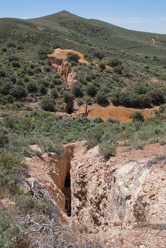
As these hydrothermal fluids get closer to the surface, however, the pressure can drop - either by fractures opening up and making more space, or by getting close enough to the surface for some of the fluid to flash into steam. When the pressure drops, the minerals can precipitate out of solution, sometime very quickly - much like the way steam pipes acquire a coating of lime and scale as the dissolved minerals precipitate when the water changes from liquid to gas. These precipitated minerals form a dense mixture of quartz, sulfides and gold crystals lining the fractures they were forced into. These fractures, now filled with minerals brought in by hydrothermal fluids are called veins. In some instances, the gold crystals within these veins can be very large. In other cases the gold crystals are very tiny an must be dug out in bulk and crushed up, allowing chemical processes to leach the other minerals away.

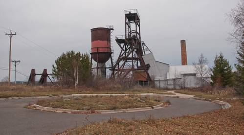
Most of the gold produced in the US today looks like this. It's then crushed up and the other minerals are leached away to reveal the gold.

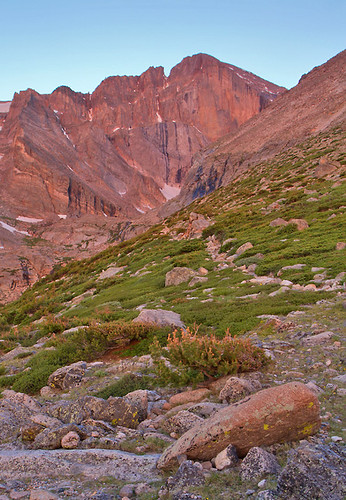
So where does that leave us with our paleo-continent of Rhovanion? If we consider the Lonely Mountain as a major gold-bearing feature of this continent, an extinct volcano seems an unlikely place to find the gold. The better spot would be the magma chamber beneath it, encircled by hydrothermal fluids, concentrating the gold into veins and big blobs. That suggests what is described as the Lonely Mountain isn't a volcano at all - at least not the surface expression of one. Rather, the Lonely Mountain is the once beating heart and associated viscera of a long-gone volcanic system. And what better place for a volcanic system than a subduction zone?

Subduction zone volcanic island. Bonus economic geology features include accretionary wedge (blue) and igneous intrusion into carbonate reef (purple) to form skarns

Next up: Iron, tectonics, and exhumed mountains!

*Speaking of which, Rhett Allain over at Dot Physics has a great post about the amount of gold in Smaug's horde.

For a complete overview of this series:
Part 1: http://pascals-puppy.blogspot.com/2013/12/unnatural-histories-lonely-mountain.html
Part 2: http://pascals-puppy.blogspot.com/2013/12/unnatural-histories-lonely-mountain_16.html
Part 3: http://pascals-puppy.blogspot.com/2013/12/unnatural-histories-lonely-mountain_9632.html
Part 4: http://pascals-puppy.blogspot.com/2013/12/unnatural-histories-lonely-mountain_1042.html
Part 5: http://pascals-puppy.blogspot.com/2013/12/unnatural-histories-lonely-mountain_5911.html

Unnatural Histories: The Lonely Mountain, Part 3

When we left, we had established the possible tectonic system responsible for the two large mountain ranges related to events in The Hobbit. The Misty Mountains to the West, and the Ered Mithrin to the North. Side note: Ered Mithrin means "Grey Mountains," and Gandalf was called "Mithrander" or "Grey Pilgrim" by the elves… Any guesses as to what "Mithril" means? Tolkien was an Oxford Professor of Linguistics after all.

In order to untangle the Misty Mountains and Ered Mithrin, I suggested we take a closer look at earlier tectonic clues. In this case, the clues found within the crust that makes up the region called "Rhovanion." Tolkien describes the area west of the Misty Mountains as "Eriador" and north of Ered Mithrin as "Forodwaith." Since geologists often use regional names as a convenient way of tracking old chunks of crust, we'll look at the paleo-continent of Rhovanion.

Geologically speaking we have a few landscape features that are probably important. First, there are several large rivers - the Anduin (The "Great River" down which Frodo and his eight companions paddled south out of Lorien). The southern-most tributary of the Anduin on this map marks the spot where Isildur was waylaid and killed by Orcs on his march back to Eriador. The One Ring he was wearing slipped off his finger and fell to the bottom of the river, to be picked up years later by a hobbit/hobbit relative named Smeagol whereupon he took it deep into the Misty Mountains, only to lose the ring and have it picked up by Bilbo on his way to the Lonely Mountain… Goodness, it's like Tolkien spent years of his life piecing together all sorts of history for this Children's book he wrote (which he did, of course). Where was I? Oh yes, rivers.

Along with the Anduin is the Forest River and the River Running - both of which flow South and East. Interesting to note the headwaters of both the Anduin and Forest rivers start in the foothills of the Ered Mithrin. While the Anduin continues straight south along the edge of the Misty Mountains, the Forest river veers off to the East towards the Sea of Rhune. Something, then is creating a drainage divide between these rivers - some topographic high in the northwest corner of Mirkwood. The River Running also skirts past and away from other topographic highs such as the Mountains of Mirkwood, the Woodland Realm of Sylvan Elves (from whence Legolas the Dreamy would come to join the Fellowship of the Ring), and the Lonely Mountain. Another river that flows into the Sea of Rhune comes south of the Iron Hills.

Thus the rivers help us locate topographic "lows" and the area between rivers helps define topographic highs. Along with the features important to the Middle Earth narrative, we get a better picture of the paleo-continent of Rhovanion.

But how do we get at it's tectonic history, now that all the easily-identified features have long been stripped away by erosion or editorial expedience? The key lies with economic geology. Namely iron and gold - the topics of my next post.


For a complete overview of this series:
Part 1: http://pascals-puppy.blogspot.com/2013/12/unnatural-histories-lonely-mountain.html
Part 2: http://pascals-puppy.blogspot.com/2013/12/unnatural-histories-lonely-mountain_16.html
Part 3: http://pascals-puppy.blogspot.com/2013/12/unnatural-histories-lonely-mountain_9632.html
Part 4: http://pascals-puppy.blogspot.com/2013/12/unnatural-histories-lonely-mountain_1042.html
Part 5: http://pascals-puppy.blogspot.com/2013/12/unnatural-histories-lonely-mountain_5911.html

Unnatural Histories: The Lonely Mountain, Part 2

I hope you've had a chance to look at a map of Middle Earth. There is a lot going on - the landscape was formed by the need of Tolkien's narrative. Tolkien was a linguist, not a geologist. But he based his descriptions on the places he knew. So his landscape draws on the same geologic history that formed our own world.

In the map above, we see three main features. On the western edge of the map is the long range of the Misty Mountains (they extend further north and south beyond this sketch). To the North lies the Ered Mithrin, or the Grey Mountains. East of the Misty Mountains lies Mirkwood - a large expanse of oak and beech forest. Incidentally, much of the plot for the Hobbit movies comes from the appendices of The Lord of the Rings and the Silmarillion. Although the plot for the movies doesn't really "follow" these sources as it uses them for general plot-directions for Peter Jackson's story. If you watch Peter Jackson's films with this in mind, you'll be much happier. But I digress...

Physiographically the Misty Mountains and the Ered Mithrin form long, linear topographic highs. These kinds of features are often indicative of tectonic stresses distributed over a large area. On earth, "active" tectonic boundaries tend to have these features. The stresses caused by one plate interacting with another deform the rocks along those boundaries. It's not unreasonable to think that the Misty Mountains indicate such a feature.

We can use the shape and orientation of the mountains to infer plate boundaries and the orientation of the stress. If you hold a phone book and push in with both hands, the book will bend. But the orientation of the bend is perpendicular to the direction you push with your hands - like so:

Deformation either from pushing on the phone book, or that caused by colliding tectonic plates, tends to be oriented away from the direction the stress is coming from. Since stress is coming from the left and the right, the least amount of stress is acting forward and backward (with regards to the above picture). So the deformation occurs in that direction.

Since the Misty Mountains are oriented North-South, we can reasonably assume the stress is coming from East-West. And since we have uplift (mountains), we probably are seeing the crust thickening at this boundary, such as happens when two plates converge on each other like India and Asia. If they were pulling away, we would see thinning of the crust - and perhaps a rift valley or three like we see in East Africa and the Arabian Peninsula.

So, we would probably make the same assumption for the Ered Mithrin. But would we be correct? It's not an unreasonable thought, since these are also a long linear uplift feature. But these are oriented perpendicular to the Misty Mountains, which we've already established as forming because the tectonic stress of two plates is oriented East-West. We need to adjust our thoughts if the Ered Mithrin is also forming due to converging plates. If, perhaps there were several plates - the plate below Mirkwood moving Northwest, into a plate on the other side of the Misty Mountains, and another North of the Ered Mithrin. This isn't easy to do all at once, so perhaps the collision forming Ered Mithrin happened first and the Misty Mountains formed later?


Perhaps - this could work, but maybe we should look earlier in time. It might be that an answer lies not with the most immediate pattern, but one formed earlier. Like the way you have a knotted ball of yarn and you can't undo the second-to-last knot until after you've undone some earlier, deeper knots.

For a complete overview of this series:
Part 1: http://pascals-puppy.blogspot.com/2013/12/unnatural-histories-lonely-mountain.html
Part 2: http://pascals-puppy.blogspot.com/2013/12/unnatural-histories-lonely-mountain_16.html
Part 3: http://pascals-puppy.blogspot.com/2013/12/unnatural-histories-lonely-mountain_9632.html
Part 4: http://pascals-puppy.blogspot.com/2013/12/unnatural-histories-lonely-mountain_1042.html
Part 5: http://pascals-puppy.blogspot.com/2013/12/unnatural-histories-lonely-mountain_5911.html

Unnatural Histories: The Lonely Mountain, Part 1

Like many of you, I saw The Hobbit: The Desolation of Smaug last weekend. Like many of you, I've read "The Hobbit" several times (and had it read to me many times before that). But how many of you have wondered what kind of mountain the Lonely Mountain really was?

Tolkein's description and drawings of the lonely mountain bring to mind an inactive volcano. With its narrow peak and symmetrical slopes. But here's my thought - the Lonely Mountain works much better as a part of a much older and much larger tectonic history of Middle Earth. Let me explain with a little background information, first.

We're told that the Lonely Mountain was a solitary peak perhaps 2,500 - 3,000 meters or so above sea level (since there was some snow on the peak year-round). Assuming the latitude/climate was similar to that of the northern Alps. We also get some backstory on the great Dwarven kingdom of Erebor, which was famous for its deposits of gold and precious gems. Mithril, Tolkien's "unobtanium," was found only in Moria - several hundred miles to the Southwest. To the east lay the Iron Hills. To get to the Lonely Mountain, Bilbo and the Dwarves had to cross the Misty Mountains - a long north-south trending line of imposing peaks.


GSA_1917

The photo above is Mt. Baker - A Composite Volcano that I photographed from the (relative) comfort of my economy airplane seat, about 30,000 feet above sea level. The summit reaches a height of about 10,780 feet above sea level. Note the relatively low-lying topography around the summit and the lovely symmetry of the mountain itself.


Tetons_9503
Here's another grand mountain peak, Grand Teton (summit is 13,775 feet above sea level) from the Garnet Trail, Grand Teton National Park Wyoming.

Tetons_9352
And here is a wider view of the Teton Range, Wyoming. Relatively young, these mountains are the direct result of extensional tectonic stresses, causing the block of crust I'm standing on (along with the barn) to drop downwards relative to the uplifted mountains in the background. But this tectonic stress is spread out along a north-south trending fault line - made of not one, but many mountain peaks worn sharp by glacial ice and not yet brought down by millions of years of erosion.


Midas_4232
This is what gold mining in the western United States used to look like - a long narrow shaft to dig into the gold-rich ore (north-central Nevada). You can see how the mine follows the "vein" of high quality ore along a linear path into the hillside. But there aren't any big mountains nearby...


LongsPeak_4279
Longs Peak at sunrise on the Chasm Lake Trail, Rocky Mountain National Park (Colorado). Another lovely mountain peak. By comparison to other areas in Colorado, the rocks in Rocky Mountain National Park are relatively poor in economically valuable minerals like gold and silver. Fortunate for us, because it was easier to set the area aside as a National Park.

Ely_0477
Abandoned Iron Mine in Ely, Minnesota. One doesn't need giant mountains to produce economically viable deposits. The iron found in northern Minnesota, Wisconsin, and the Upper Peninsula of Michigan comes from ancient sea-floor deposits over one billion years old.

So we're faced with a few questions. First, if the Lonely Mountain was once a volcano, why is it extinct? What kinds of patterns left by geologic processes here on Earth similar to those described by Tolkien? How do we get gold deposits in such abundance (aside from the "because, magic" clause)? Why did I include a picture of an iron mine?

For this first part, I'm going to leave you with a quick sketch map (drafted in "ArtRage" on my iPad). Look over the topography - where are there areas of likely active tectonics?

Next, I'll go over some of the features and discuss what might lie below the surface as a product of things that happen over what we geologists like to call "deep time."

For a complete overview of this series:
Part 1: http://pascals-puppy.blogspot.com/2013/12/unnatural-histories-lonely-mountain.html
Part 2: http://pascals-puppy.blogspot.com/2013/12/unnatural-histories-lonely-mountain_16.html
Part 3: http://pascals-puppy.blogspot.com/2013/12/unnatural-histories-lonely-mountain_9632.html
Part 4: http://pascals-puppy.blogspot.com/2013/12/unnatural-histories-lonely-mountain_1042.html
Part 5: http://pascals-puppy.blogspot.com/2013/12/unnatural-histories-lonely-mountain_5911.html

Friday, December 13, 2013

If it ain't Scottish, it's crap!*

Our cats like my wife's lap. It would appear that they are either not bound by the Pauli Exclusion Principle, or Pippin has a different integer spin than Birke.


*Title of this post comes from my high school physics class where my friends and I decided that phrase as an alternate explanation of the Pauli Exclusion Principle. And yes, Wolfgang Pauli was Austrian, but SNL was one of our primary meme generators back in the day...