Tolkein's description and drawings of the lonely mountain bring to mind an inactive volcano. With its narrow peak and symmetrical slopes. But here's my thought - the Lonely Mountain works much better as a part of a much older and much larger tectonic history of Middle Earth. Let me explain with a little background information, first.
We're told that the Lonely Mountain was a solitary peak perhaps 2,500 - 3,000 meters or so above sea level (since there was some snow on the peak year-round). Assuming the latitude/climate was similar to that of the northern Alps. We also get some backstory on the great Dwarven kingdom of Erebor, which was famous for its deposits of gold and precious gems. Mithril, Tolkien's "unobtanium," was found only in Moria - several hundred miles to the Southwest. To the east lay the Iron Hills. To get to the Lonely Mountain, Bilbo and the Dwarves had to cross the Misty Mountains - a long north-south trending line of imposing peaks.
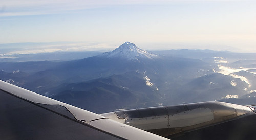
The photo above is Mt. Baker - A Composite Volcano that I photographed from the (relative) comfort of my economy airplane seat, about 30,000 feet above sea level. The summit reaches a height of about 10,780 feet above sea level. Note the relatively low-lying topography around the summit and the lovely symmetry of the mountain itself.
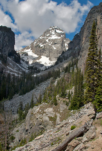
Here's another grand mountain peak, Grand Teton (summit is 13,775 feet above sea level) from the Garnet Trail, Grand Teton National Park Wyoming.
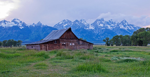
And here is a wider view of the Teton Range, Wyoming. Relatively young, these mountains are the direct result of extensional tectonic stresses, causing the block of crust I'm standing on (along with the barn) to drop downwards relative to the uplifted mountains in the background. But this tectonic stress is spread out along a north-south trending fault line - made of not one, but many mountain peaks worn sharp by glacial ice and not yet brought down by millions of years of erosion.
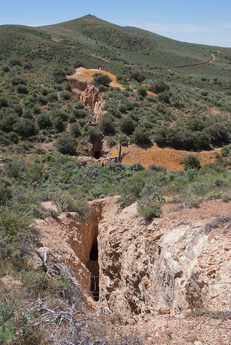
This is what gold mining in the western United States used to look like - a long narrow shaft to dig into the gold-rich ore (north-central Nevada). You can see how the mine follows the "vein" of high quality ore along a linear path into the hillside. But there aren't any big mountains nearby...
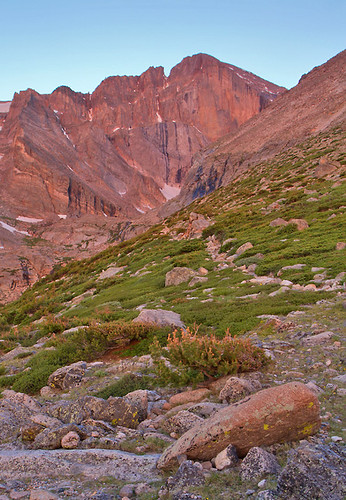
Longs Peak at sunrise on the Chasm Lake Trail, Rocky Mountain National Park (Colorado). Another lovely mountain peak. By comparison to other areas in Colorado, the rocks in Rocky Mountain National Park are relatively poor in economically valuable minerals like gold and silver. Fortunate for us, because it was easier to set the area aside as a National Park.
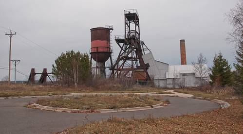
Abandoned Iron Mine in Ely, Minnesota. One doesn't need giant mountains to produce economically viable deposits. The iron found in northern Minnesota, Wisconsin, and the Upper Peninsula of Michigan comes from ancient sea-floor deposits over one billion years old.
So we're faced with a few questions. First, if the Lonely Mountain was once a volcano, why is it extinct? What kinds of patterns left by geologic processes here on Earth similar to those described by Tolkien? How do we get gold deposits in such abundance (aside from the "because, magic" clause)? Why did I include a picture of an iron mine?
For this first part, I'm going to leave you with a quick sketch map (drafted in "ArtRage" on my iPad). Look over the topography - where are there areas of likely active tectonics?
For a complete overview of this series:
Part 1: http://pascals-puppy.blogspot.com/2013/12/unnatural-histories-lonely-mountain.html
Part 2: http://pascals-puppy.blogspot.com/2013/12/unnatural-histories-lonely-mountain_16.html
Part 3: http://pascals-puppy.blogspot.com/2013/12/unnatural-histories-lonely-mountain_9632.html
Part 4: http://pascals-puppy.blogspot.com/2013/12/unnatural-histories-lonely-mountain_1042.html
Part 5: http://pascals-puppy.blogspot.com/2013/12/unnatural-histories-lonely-mountain_5911.html

I've had similar questions. I see rift valleys, and also, something like the Rwenzori pushup, which allows any kind of earlier formation to be up high in a mountain. I would look at the Western Rift Valley for analogues.
ReplyDeleteAlso, this: http://scienceblogs.com/gregladen/2013/12/17/have-dragons-orcs-and-wizards-caused-climate-change/
ReplyDeleteGreg,
ReplyDeleteRift valleys are fascinating places for tectonic puzzles. Lots of heat flow means more buoyant crust and general uplift even though the crust is thinning. And the melt compositions can be really weird (like Longai's carbonanite lavas).